Erattupetta
Erattupetta is a municipal town located in Kottayam district of the state of Kerala, India, close to the place Aruvithura. It is located 38 km east of Kottayam, the district capital. Erattupetta Grama Panchayath was founded in 1964 and upgraded to a municipality in 2015.
Erattupetta | |
|---|---|
Town | |
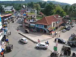 Town's junction | |
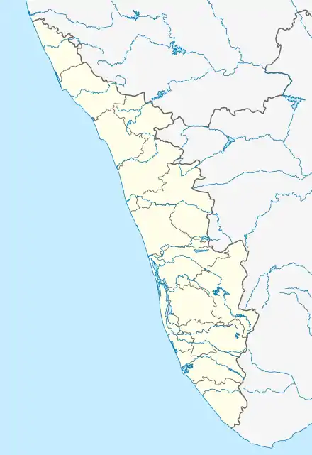 Erattupetta Location in Kerala, India  Erattupetta Erattupetta (India) | |
| Coordinates: 9.7°N 76.78°E | |
| Country | |
| State | Kerala |
| District | Kottayam |
| Government | |
| • Type | Municipality |
| • Municipal Chairperson | Suhara Abdul Khader |
| • Municipal Vice Chairman | Muhammad Ilyas (INC) |
| Area | |
| • Total | 14.24 km2 (5.50 sq mi) |
| Elevation | 24 m (79 ft) |
| Population (2011) | |
| • Total | 34,000 |
| • Density | 2,400/km2 (6,200/sq mi) |
| Languages | |
| • Official | Malayalam, English |
| Time zone | UTC+5:30 (IST) |
| Vehicle registration | KL-35 |
| Literacy | 95% |
| Website | https://erattupettamunicipality.lsgkerala.gov.in/en/ |
The Historical Pilgrim centre St. George's Syro-Malabar Catholic Forane Church, Aruvithura is in erattupetta municipality.
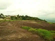
The "Eraaru" part in all the variation of the names arose from the geographical location, where the two rivers (aru) merge as single one and "Petta" means town. Erattupetta is situated in the foothills of High Ranges. Hence the place is also known as "the gateway of Highrange/Malanadu."
Etymology
The "Eraaru" part in all the variation of the names arose from the geographical location, where the two rivers (aru) merge as a single one. Erattupetta is situated in the foothills of High Ranges. 'Peta' means town in Dravidian languages. Earlier it was known as 'Erapoli' or 'Erapuzha'. It was the commercial capital of the Poonjar principality until 1949.
Economy
In the past, hill produce from the Cardamom hills were brought down by the Muthuvans for trade. Erattupetta is a famous trading center for spices, rubber, arecanut and other agricultural products. Wagamon, a Hill Station, lies some 22 km east of Erattupetta . Erattupetta has a good number of expatriate population living in Gulf countries, especially in United Arab Emirates and Saudi Arabia.
Demographics
As of 2001 India census, Erattupetta had a population of 29,675. Males constitute 51% of the population and females 49%. Erattupetta has an average literacy rate of 90%, higher than the national average of 59.5%: male literacy is 83%, and female literacy is 76%. In Erattupetta, 14% of the population is under 6 years of age.
Educational institutions
- St.George College, Aruvithura.
- MES College Erattupetta.
- St. George Higher Secondary School, Aruvithura
- Government Muslim LP School, Nadackal post , Erattupetta
- PMSAPTM LP School, Kaduvamoozhy,erattupetta
- St. Alphonsa Public School & Junior College, Aruvithura
- MMMUM UP School,Nadackal post ,Erattupetta
- St. Mary’s LP School, Aruvithura
- Thanmiya Islamic School, Nadackal post , Erattupetta
- Georgian College, aruvithura
- Al-Fitra Islamic School, Erattupetta
- Guidance Public School, Poonjar, Erattupetta
- Al-manar Senior Secondary School, Vattakkayam, Erattupetta
- Government Higher Secondary School, Erattupetta
- Hayathudheen High School, Crossway Road, Erattupetta
- Muslim Girls Higher Secondary School, Nadackal, Erattupetta
- University College of Teacher Education, Erattupetta
Temples
Angalamman Temple:
Angalamman Temple (അങ്കാളമ്മൻ ക്ഷേത്രം) is located in Nadackal. Nadackal Bhagavathi Temple Nadackal Sree Bhagwathi Temple has the deity of Bhadrakali. The idol is a Kannady Bimbam.Nadackal Kavu
Mosques
Over 60 mosques are situated in Erattupetta.
- Ninar Palli Juma Masjid
- Noorul Huda Masjid, Aruvithura
- Puthenpalli Juma Masjid
- Muhyidheen Juma Masjid,Aruvithura
Muhyidheen Juma Masjid subsidiary are:
- Sahaba Masjid Chennadu Kavala, Aruvithura
- Daras Masjid, Chennadu Kavala, Aruvithura,
- Madeena Masjid, Chennad road,
- Jeelani Masjid, Kanjirappally road,
- Thaqua Masjid, Mandhakinnu Road,
- Salafi Msjid, Crossway road, Erattupetta
Banks
- The Meenachil East Urban Co-operative Bank Ltd. No. 4266, Aruvithura Branch.
Aruvithura.P.O, Pin : 686 122, Ph : 04822-272351, Mob:7510431004 / Office Time :9.30am To 1.30pm & 2pm To 4.30 pm , / Cash Counter Time: 9.30am To 1.30pm & 2pm To 4.00 pm.
Geography
Erattupetta can be accessed easily from north Kerala via the Angamaly-Muvattupuzha-Thodupuzha-Muttom route. It is well connected to Tamil Nadu via Kottayam-Kumali (K K) Road to Madurai through the nearest town Mundakkayam via Parathanam, which is 27 kilometres from Erattupetta.
It has an average elevation of 36 metres (118 feet).
Access
- The K.S.R.T.C Bus Stand is situated in Aruvithura, close to St. George Forane Church, Aruvithura
- Tiruvananthapuram - Kilimanoor - Kottarakkara - Pathanamthitta - Ranni - Erumeli - Kanjirappally - Erattupetta 164 km
- Kottayam - Ettumanoor - Pala - Erattupetta 39 km
- Kochi/Cochin - Thrippunithura - Piravom - Elanji - Uzhavoor - Pala - Erattupetta 78 km
- Thrissur/Trichur-Chalakudy - Angamaly - Perumbavoor - Muvattupuzha - Thodupuzha - Erattupetta 130 km
- Kozhikode - Kuttippuram - Thrissur - Muvattupuzha - Thodupuzha - Erattupetta 255 km
- Cochin International Airport - Kalady - Perumbavoor - Muvattupuzha - Thodupuzha - Erattupetta 84 km
- Mundakkayam- Parathanam - Poonjar - Panachikappara - Erattupetta 27 km
Politics
Erattupetta is a municipality. The current municipal chairperson is Smt. Suhara Abdul Khader.
Erattupetta comes under the Pathanamthitta loksabha constituency and the Poonjar assembly constituency. Erattupetta is represented in the Loksabha by Sri Anto Antony and in the state assembly by Sri Sebastian Kulathunkal.
Sri. P.C George (Planthottathil Chacko George - Born 28 August 1951) , who served as the Members of Kerala Legislative Assembly for 33 years, is from Aruvithura.