Amfreville-la-Mi-Voie
Amfreville-la-Mi-Voie is a commune in the Seine-Maritime department in the Normandy region in northern France.
Amfreville-la-Mi-Voie | |
|---|---|
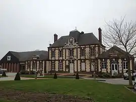 The town hall in Amfreville-la-Mi-Voie | |
.svg.png.webp) Coat of arms | |
Location of Amfreville-la-Mi-Voie 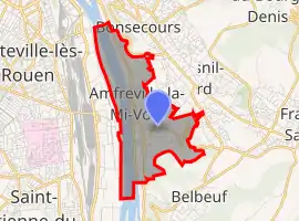 | |
 Amfreville-la-Mi-Voie 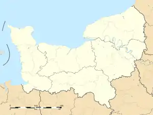 Amfreville-la-Mi-Voie | |
| Coordinates: 49°24′10″N 1°07′52″E | |
| Country | France |
| Region | Normandy |
| Department | Seine-Maritime |
| Arrondissement | Rouen |
| Canton | Darnétal |
| Intercommunality | Métropole Rouen Normandie |
| Government | |
| • Mayor (2020–2026) | Hugo Langlois[1] |
| Area 1 | 3.89 km2 (1.50 sq mi) |
| Population | 3,306 |
| • Density | 850/km2 (2,200/sq mi) |
| Time zone | UTC+01:00 (CET) |
| • Summer (DST) | UTC+02:00 (CEST) |
| INSEE/Postal code | 76005 /76920 |
| Elevation | 3–145 m (9.8–475.7 ft) (avg. 45 m or 148 ft) |
| 1 French Land Register data, which excludes lakes, ponds, glaciers > 1 km2 (0.386 sq mi or 247 acres) and river estuaries. | |
Geography
A small light industrial town situated by the banks of the river Seine in the southern suburbs of Rouen at the junction of the D6015 and the D94 roads.
Population
| Year | 1962 | 1968 | 1975 | 1982 | 1990 | 1999 | 2006 |
|---|---|---|---|---|---|---|---|
| Population | 2389 | 2430 | 2093 | 2509 | 2556 | 2869 | 3056 |
| From the year 1962 on: No double counting—residents of multiple communes (e.g. students and military personnel) are counted only once. | |||||||
Places of interest
- The church of St.Remi, dating from the early 20th century.
- The mairie, built in 1884.
- The Lacoste public park.
References
- "Répertoire national des élus: les maires". data.gouv.fr, Plateforme ouverte des données publiques françaises (in French). 9 August 2021.
- "Populations légales 2019". The National Institute of Statistics and Economic Studies. 29 December 2021.
External links
| Wikimedia Commons has media related to Amfreville-la-Mi-Voie. |
- Official website of the commune (in French)
This article is issued from Wikipedia. The text is licensed under Creative Commons - Attribution - Sharealike. Additional terms may apply for the media files.