Agnat
Agnat is a commune in the Haute-Loire department and Auvergne-Rhône-Alpes region of south-east central France.
Agnat | |
|---|---|
Commune | |
 | |
Location of Agnat 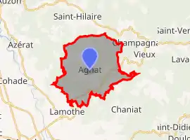 | |
 Agnat 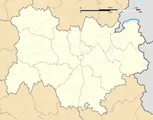 Agnat | |
| Coordinates: 45°20′39″N 3°26′58″E | |
| Country | France |
| Region | Auvergne-Rhône-Alpes |
| Department | Haute-Loire |
| Arrondissement | Brioude |
| Canton | Sainte-Florine |
| Intercommunality | Brioude Sud Auvergne |
| Government | |
| • Mayor (2020–2026) | Christian Passemard[1] |
| Area 1 | 19.65 km2 (7.59 sq mi) |
| Population | 178 |
| • Density | 9.1/km2 (23/sq mi) |
| Time zone | UTC+01:00 (CET) |
| • Summer (DST) | UTC+02:00 (CEST) |
| INSEE/Postal code | 43001 /43100 |
| Elevation | 445–860 m (1,460–2,822 ft) (avg. 667 m or 2,188 ft) |
| 1 French Land Register data, which excludes lakes, ponds, glaciers > 1 km2 (0.386 sq mi or 247 acres) and river estuaries. | |
Population
| Year | Pop. | ±% |
|---|---|---|
| 2005 | 190 | — |
| 2006 | 190 | +0.0% |
| 2007 | 189 | −0.5% |
| 2008 | 189 | +0.0% |
| 2009 | 190 | +0.5% |
| 2010 | 190 | +0.0% |
| 2011 | 190 | +0.0% |
| 2012 | 189 | −0.5% |
| 2013 | 189 | +0.0% |
| 2014 | 189 | +0.0% |
| 2015 | 189 | +0.0% |
| 2016 | 187 | −1.1% |
References
- "Répertoire national des élus: les maires". data.gouv.fr, Plateforme ouverte des données publiques françaises (in French). 2 December 2020.
- "Populations légales 2019". The National Institute of Statistics and Economic Studies. 29 December 2021.
| Wikimedia Commons has media related to Agnat. |
This article is issued from Wikipedia. The text is licensed under Creative Commons - Attribution - Sharealike. Additional terms may apply for the media files.