Abbéville-lès-Conflans
Abbéville-lès-Conflans (French pronunciation: [abevil le kɔ̃flɑ̃], literally Abbéville near Conflans) is a commune in the Meurthe-et-Moselle department in northeastern France.
Abbéville-lès-Conflans | |
|---|---|
 The church in Abbéville-lès-Conflans | |
 Coat of arms | |
Location of Abbéville-lès-Conflans 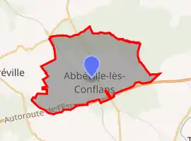 | |
 Abbéville-lès-Conflans 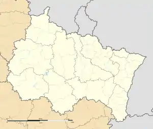 Abbéville-lès-Conflans | |
| Coordinates: 49°11′55″N 5°50′43″E | |
| Country | France |
| Region | Grand Est |
| Department | Meurthe-et-Moselle |
| Arrondissement | Briey |
| Canton | Pays de Briey |
| Intercommunality | Orne Lorraine Confluences |
| Government | |
| • Mayor (2020-2026) | Daniel Poleggi |
| Area 1 | 7.73 km2 (2.98 sq mi) |
| Population | 232 |
| • Density | 30/km2 (78/sq mi) |
| Demonym(s) | Abbévillois, Abbévilloises |
| Time zone | UTC+01:00 (CET) |
| • Summer (DST) | UTC+02:00 (CEST) |
| INSEE/Postal code | 54002 /54800 |
| Elevation | 196–230 m (643–755 ft) (avg. 224 m or 735 ft) |
| 1 French Land Register data, which excludes lakes, ponds, glaciers > 1 km2 (0.386 sq mi or 247 acres) and river estuaries. | |
Population
|
| ||||||||||||||||||||||||||||||||||||||||||||||||||||||||||||||||||||||||||||||||||||||||||||||||||||||||||||||||||||||||||||||||||||||||||
| Source: EHESS[2] and INSEE[3][4] | |||||||||||||||||||||||||||||||||||||||||||||||||||||||||||||||||||||||||||||||||||||||||||||||||||||||||||||||||||||||||||||||||||||||||||
Inhabitants are called Abbévillois.
References
- "Populations légales 2019". The National Institute of Statistics and Economic Studies. 29 December 2021.
- Des villages de Cassini aux communes d'aujourd'hui: Commune data sheet Abbéville-lès-Conflans, EHESS. (in French)
- Population en historique depuis 1968, INSEE
- Historique des populations légales
| Wikimedia Commons has media related to Abbéville-lès-Conflans. |
This article is issued from Wikipedia. The text is licensed under Creative Commons - Attribution - Sharealike. Additional terms may apply for the media files.