Šēdere parish
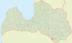
Šēdere Parish is an administrative territory of Augšdaugava Municipality in the Selonia region of Latvia. It was established under the 1920 land reform, and was previously known as Laši parish. It is situated on the southern border with Lithuania.
- Šēdere - parish administrative center
Šēdere parish | |
|---|---|
 | |
| Country | Latvia |
| Area | |
| • Total | 114.78 km2 (44.32 sq mi) |
| • Land | 112.87 km2 (43.58 sq mi) |
| • Water | 1.91 km2 (0.74 sq mi) |
| Population (1 January 2021)[2] | |
| • Total | 703 |
| • Density | 6.1/km2 (16/sq mi) |
See also
- Pašulienes mežs Nature Reserve
- Raudas meži Nature Reserve
References
| Wikimedia Commons has media related to Šēdere parish. |
- https://data.stat.gov.lv/pxweb/lv/OSP_PUB/START__ENV__DR__DRT/DRT010/; Central Statistical Bureau of Latvia; retrieved: 26 February 2021.
- https://data.stat.gov.lv/pxweb/lv/OSP_PUB/START__POP__IR__IRS/IRD060/; Central Statistical Bureau of Latvia; retrieved: 15 June 2021.
This article is issued from Wikipedia. The text is licensed under Creative Commons - Attribution - Sharealike. Additional terms may apply for the media files.